Have you ever found yourself staring at a topographic map, completely baffled by the array of lines and symbols? If so, fear not! “Understanding Topographic Maps: A Guide to GPS Navigation” is here to demystify the world of topographic maps and show you how to use them confidently with your GPS. This comprehensive guide provides clear explanations and practical tips on reading topographic maps, understanding contour lines, and utilizing GPS navigation to pinpoint your location and navigate with ease. Whether you’re an outdoor enthusiast, an adventurer, or simply curious about maps, this guide is your go-to resource for unraveling the mysteries of topographic maps and unleashing the full potential of your GPS device.
Understanding Topographic Maps: A Guide to GPS Navigation

This image is property of i0.wp.com.
Definition and Purpose of Topographic Maps
Topographic maps are detailed and accurate representations of the Earth’s surface, showcasing various physical features such as mountains, valleys, rivers, and forests. These maps provide a visual representation of the three-dimensional world in a two-dimensional form. The purpose of topographic maps is to help individuals navigate and understand the terrain, making them invaluable tools for hikers, backpackers, geologists, and outdoor enthusiasts.
Key Components of Topographic Maps
To effectively use topographic maps for GPS navigation, it is essential to understand their key components. These include map scale, contour lines, elevation and relief, symbols and legends, map orientation, grid references, latitude and longitude, UTM coordinates, and the use of a compass. Each of these components contributes to creating a comprehensive depiction of the landscape and aids in accurate GPS navigation.

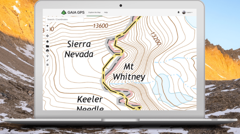
This image is property of cdn.hswstatic.com.
Understanding Map Scale
Map scale refers to the relationship between the distance on a map and the actual distance on the ground. It is typically represented as a ratio, such as 1:24,000, where one unit on the map equals 24,000 units on the ground. Understanding map scale allows you to estimate distances and determine the proportion of the depicted area. This knowledge is crucial for planning routes and measuring distances while using a GPS with topographic maps.
Contour Lines: The Language of Topographic Maps
Contour lines are one of the most crucial elements of topographic maps. They represent the shape and elevation of the terrain, helping you visualize the steepness of slopes, valleys, and hills. Contour lines connect points on the map with the same elevation, forming a continuous line. By observing the contour lines, you can easily identify ridges, depressions, and other landforms. Carefully studying contour lines is key to safe and efficient navigation, especially in challenging terrains.

This image is property of hikingguy.com.
Interpreting Elevation and Relief
Elevation refers to the height of a specific point above sea level, whereas relief represents the vertical difference between the highest and lowest points in a given area. Topographic maps provide elevation information through contour lines, spot elevations, and benchmarks. Spot elevations indicate the precise elevation of specific points, while benchmarks are permanent markers with known elevations. Understanding elevation and relief is crucial for assessing the difficulty of a route and determining potential challenges during GPS navigation.
Reading and Understanding Symbols and Legends
Topographic maps include symbols and legends to represent various physical and cultural features, such as roads, buildings, water bodies, forests, and boundaries. These symbols provide crucial information for navigation and understanding the landscape. The map’s legend explains the meaning and significance of these symbols, allowing you to decipher the map accurately. Familiarizing yourself with common symbols and their meanings ensures effective use of the topographic map in conjunction with a GPS device.

This image is property of i0.wp.com.
Map Orientation and Grid References
Map orientation refers to aligning the map with the real world, ensuring that north on the map corresponds to geographic north. Orienting the map correctly allows you to navigate accurately using a compass or GPS device. Grid references are a system of alphanumeric coordinates used to identify specific locations on a map. Understanding how to read and use grid references enables precise position determination, route planning, and successful navigation when employing topographic maps.
Understanding Latitude and Longitude
Latitude and longitude are geographical coordinate systems that enable precise global location identification. Latitude represents the distance north or south of the Equator, while longitude indicates the distance east or west of the Prime Meridian. Topographic maps often provide latitude and longitude lines, allowing you to identify specific locations, mark waypoints, and navigate accurately using GPS devices. Understanding latitude and longitude and their representation on topographic maps is vital for effective navigation.

This image is property of i0.wp.com.
Using UTM Coordinates
Universal Transverse Mercator (UTM) coordinates are another coordinate system widely used with topographic maps and GPS devices. UTM divides the Earth into 60 zones, each covering six degrees of longitude. The UTM coordinate system utilizes eastings (horizontal) and northings (vertical) to specify locations within a specific zone. UTM coordinates offer a more straightforward approach to map reading and navigation, especially for those unfamiliar with latitude and longitude. Knowing how to use UTM coordinates can enhance your skills in GPS navigation with topographic maps.
Using a Compass with Topographic Maps
A compass is a valuable tool to complement topographic maps and GPS devices for navigation. It helps establish direction and aids in orienting the map correctly. By aligning the compass with the map’s magnetic north or grid lines, you can determine the bearing and navigate with confidence. Additionally, a compass provides a backup navigational method when GPS devices are not available or lose signal. Learning how to properly use a compass enhances your skills in utilizing topographic maps for GPS navigation.
Using GPS for Navigation
Global Positioning System (GPS) technology has revolutionized navigation, particularly in outdoor activities. GPS devices receive signals from multiple satellites to determine precise geographic coordinates, enabling accurate positioning and navigation. When combined with topographic maps, GPS devices offer real-time tracking, waypoint marking, route planning, and electronic guidance. Familiarizing yourself with basic GPS operations ensures efficient and successful navigation, especially in remote or unfamiliar areas.
Working with GPS Units
To effectively use GPS units for navigation, it is essential to understand their features and functionalities. GPS devices vary in their capabilities and user interfaces, but common features include waypoint setting, track recording, route planning, and navigation prompts. Learning how to efficiently operate and interpret GPS functions enhances your ability to utilize topographic maps and GPS together seamlessly. Regular practice with your GPS unit helps build confidence and proficiency in GPS-assisted navigation.
Tips for Successful GPS Navigation with Topographic Maps
To make the most of your GPS navigation with topographic maps, consider the following tips:
- Always carry a reliable GPS device with a fully charged battery and backup batteries or a power bank.
- Familiarize yourself with the operation and features of your GPS unit before embarking on a trip.
- Calibrate your GPS device regularly to ensure accurate readings.
- Keep your topographic maps in a waterproof and durable case to protect them from damage.
- Regularly update your map software or download the latest map versions to stay informed about changes in the terrain.
- Practice using your GPS device and topographic maps in familiar areas to build confidence before exploring unknown territories.
- Utilize multiple navigational methods, such as GPS, maps, compass, and natural landmarks, to cross-verify your location and maintain situational awareness.
- Stay updated on weather conditions, potential hazards, and land access regulations in the area you plan to navigate.
- Join outdoor navigation courses or workshops to enhance your skills in GPS-assisted navigation and map reading.
By understanding topographic maps, utilizing GPS technology, and practicing effective navigation techniques, you can confidently explore the great outdoors, embark on thrilling adventures, and safely navigate through diverse terrains. Happy exploring!