If you’ve ever wondered how outdoor GPS devices can accurately track your elevation, then it’s time to uncover the mystery behind the altimeter. In this article, we’ll explore the function of an altimeter in outdoor GPS devices and how it plays a crucial role in determining your altitude. Whether you’re an avid hiker, a thrill-seeking mountaineer, or simply someone who loves exploring the great outdoors, understanding the function of an altimeter will give you a new perspective on the technology that guides you on your adventures. So, let’s dive in and discover the fascinating world of altimeters in outdoor GPS devices.

This image is property of Amazon.com.
Role of an Altimeter
An altimeter plays a crucial role in outdoor GPS devices, providing valuable information about altitude, serving as a navigational aid, and tracking vertical speed. Whether you are a mountaineer, pilot, or outdoor enthusiast, understanding the function of an altimeter is essential for safe and accurate navigation.
Measuring Altitude
One of the primary functions of an altimeter is to measure altitude. Altitude refers to the height above a given reference point, typically sea level. By accurately measuring altitude, an altimeter enables you to determine your location in terms of vertical distance. This information is vital when navigating through challenging terrain, such as mountains or deep canyons, where changes in altitude can significantly impact your route.
Navigational Aid
Another important role of an altimeter in outdoor GPS devices is to serve as a navigational aid. By providing real-time altitude data, an altimeter helps determine your position relative to known landmarks, mountain peaks, or other topographical features. This information allows you to gain a better understanding of your surroundings and aids in route planning and navigation. By knowing the altitude profile of your route, you can anticipate changes in terrain and make informed decisions to ensure a safe and successful journey.
Tracking Vertical Speed
In addition to measuring altitude and assisting with navigation, an altimeter also tracks vertical speed. Vertical speed refers to the rate at which you ascend or descend. This feature is particularly useful for adventurers engaging in activities such as mountaineering, skydiving, or hang gliding. By monitoring your vertical speed, you can keep track of your progress and ensure a safe and controlled descent or ascent. Athletes can also utilize this feature during training to monitor their performance and improve their climbing or descending abilities.
Types of Altimeters
There are various types of altimeters used in outdoor GPS devices, each with its own set of advantages and limitations. The three main types are pressure-based altimeter, GPS-based altimeter, and barometric altimeter. Let’s take a closer look at each of them.
Pressure-based Altimeter
The pressure-based altimeter relies on changes in atmospheric pressure to determine altitude. As you ascend, the atmospheric pressure decreases, and conversely, it increases as you descend. The altimeter uses a built-in barometric pressure sensor to measure these changes and calculate your altitude. This type of altimeter is widely used and offers reliable results, especially over short distances.
GPS-based Altimeter
A GPS-based altimeter utilizes satellite signals to determine altitude. By triangulating signals from multiple satellites, the altimeter can calculate your position in three-dimensional space, including your altitude. This type of altimeter relies on a reliable GPS signal and is generally accurate over long distances. However, it may encounter challenges in areas with obstructed or weak satellite reception, such as dense forests or deep canyons.
Barometric Altimeter
A barometric altimeter, also known as a barometer, uses changes in barometric pressure to measure altitude. This type of altimeter is similar to a pressure-based altimeter, but instead of absolute atmospheric pressure, it focuses on changes in local barometric pressure. By calibrating the altimeter based on known reference points, such as a known altitude, the device can accurately determine your current altitude. Barometric altimeters are commonly found in wrist-mounted outdoor GPS devices and offer reliable altitude measurements.

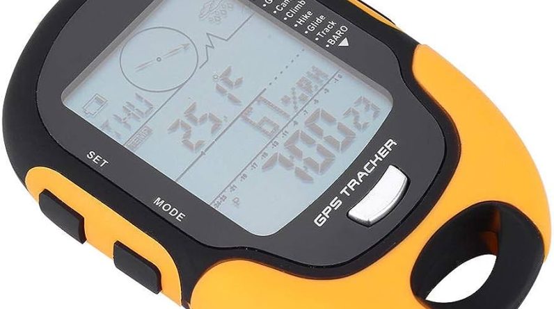
This image is property of Amazon.com.
Working Principle
To understand the working principle of an altimeter, let’s explore how each type of altimeter measures altitude.
Pressure Measurement
Both pressure-based altimeters and barometric altimeters rely on changes in atmospheric pressure to measure altitude. As you move up or down in elevation, the atmospheric pressure changes accordingly. These altimeters use a pressure sensor to detect these changes and convert them into altitude measurements. By calibrating the sensor to a known reference point, such as sea level, the device can accurately calculate your current altitude based on the prevailing atmospheric pressure.
Satellite Signals
GPS-based altimeters utilize signals from multiple satellites to determine altitude. These satellites continuously transmit positioning signals that are received by the GPS device. By measuring the time it takes for the signals to travel from the satellites to the device, the GPS receiver can calculate the distance to each satellite and triangulate its position in three-dimensional space, including the altitude. The accuracy of the altitude measurement depends on the quality of the GPS signal and the number of satellites in view.
Barometric Pressure Changes
Barometric altimeters use changes in local barometric pressure to determine altitude. They measure the changes in atmospheric pressure caused by changes in elevation. By calibrating the altimeter based on a reference point, such as a known altitude, it can accurately calculate your current altitude based on the observed changes in the barometric pressure. However, barometric altimeters are susceptible to changes in weather conditions, as variations in atmospheric pressure due to weather systems can affect the accuracy of the altitude measurement.
Measuring Altitude
Now that we understand how altimeters work, let’s discuss the different methods used to measure altitude with each type of altimeter.
Pressure-based Altitude Measurement
Pressure-based altimeters measure altitude by detecting changes in atmospheric pressure. As you ascend, the altimeter records a decrease in pressure, indicating an increase in altitude. Conversely, as you descend, the pressure increases, signaling a decrease in altitude. These altimeters often display altitude readings in feet or meters, allowing you to track your vertical position during your outdoor activities.
GPS-based Altitude Measurement
GPS-based altimeters calculate altitude by triangulating signals from multiple satellites. By determining the distance between the satellites and the GPS device, the altitude can be accurately estimated. These altimeters typically provide altitude measurements in feet or meters, similar to pressure-based altimeters. However, it’s important to note that the accuracy of the altitude measurement can vary depending on the quality of the GPS signal and the number of satellites in view.
Barometric Altimeter Measurement
Barometric altimeters measure altitude using changes in local barometric pressure. By calibrating the altimeter based on a known reference point, such as a known altitude, it can accurately calculate your current altitude based on the observed changes in barometric pressure. These altimeters display altitude readings in feet or meters and are commonly found in wrist-mounted outdoor GPS devices.

This image is property of Amazon.com.
Navigational Aid
One of the most valuable roles of an altimeter in outdoor GPS devices is its ability to serve as a navigational aid. Let’s explore how an altimeter can assist with navigation.
Determining Topography
By providing accurate altitude measurements, an altimeter allows you to determine your position relative to topographical features. Whether you’re trekking through mountains, exploring valleys, or navigating near cliffs, knowing your altitude enables you to identify significant landmarks and assess the terrain ahead. This information is particularly valuable when planning your route and avoiding potentially hazardous areas.
Creating Elevation Profiles
An altimeter helps create elevation profiles, providing a visual representation of changes in altitude along a specific route. Elevation profiles display the vertical ascent and descent over a given distance, allowing you to anticipate challenging sections of your journey. By analyzing the elevation profile, you can plan rest stops, conserve energy, and adjust your pace accordingly to ensure a successful and enjoyable adventure.
Route Planning
With the help of an altimeter, you can plan your routes more effectively. By understanding the altitude changes along your desired path, you can choose the most suitable route based on your fitness level, equipment, and objectives. If you prefer a more gradual ascent or descent, an altimeter can guide you to select routes that meet your preferences. By incorporating altitude information into your route planning, you can maximize your safety and enjoyment while exploring the great outdoors.
Tracking Vertical Speed
Another important aspect of an altimeter in outdoor GPS devices is its ability to track vertical speed. Let’s explore how this feature can be utilized.
Measuring Ascent and Descent Speed
An altimeter allows you to accurately measure your ascent and descent speed. Whether you’re climbing a mountain or descending while skiing, tracking your vertical speed provides valuable insights into your performance and progress. By monitoring your ascent and descent rates, you can adjust your pace, conserve energy, and achieve your climbing or descending goals. This feature is especially beneficial for mountaineers, skiers, and hikers who aim for speed or efficiency during their outdoor endeavors.
Training Tool for Athletes
For athletes seeking to improve their climbing or descending abilities, an altimeter can serve as a valuable training tool. By monitoring your vertical speed during training sessions, you can track your progress over time and identify areas for improvement. Whether you’re a professional cyclist striving to conquer challenging mountain passes or a trail runner aiming for faster descents, an altimeter provides objective data to help you refine your technique, adjust your training regimen, and ultimately enhance your performance.
Safe Parachuting or Hang Gliding
For adrenaline junkies engaging in activities such as parachuting or hang gliding, an altimeter is an essential tool for safety. These altimeters are typically worn on the wrist or integrated into specialized equipment and provide real-time altitude information. By constantly monitoring your altitude during these high-risk activities, you can ensure a safe and controlled descent or ascent, while staying within designated altitudinal safety zones.

This image is property of u7q2x7c9.stackpathcdn.com.
Pressure-based Altimeter
One type of altimeter commonly found in outdoor GPS devices is the pressure-based altimeter. Let’s explore its functionality and limitations.
Using Atmospheric Pressure
Pressure-based altimeters rely on changes in atmospheric pressure to measure altitude. These altimeters house a highly sensitive barometric pressure sensor that detects even the smallest variations in pressure. As you ascend or descend, the sensor captures these changes and converts them into altitude readings. While pressure-based altimeters provide relatively accurate altitude measurements, they rely on the assumption that atmospheric conditions are consistent throughout your journey.
Calibration and Accuracy
To ensure accuracy, pressure-based altimeters need to be calibrated to a known reference point. Most devices allow you to input a known altitude, such as sea level, to align the altimeter’s readings with the actual altitude at your location. However, it’s important to recalibrate the altimeter periodically, especially when moving to a significantly different altitude or encountering extreme weather conditions that may affect atmospheric pressure.
Limitations
Pressure-based altimeters have certain limitations. They are subject to inaccuracies caused by changes in weather conditions or air pressure. Sudden weather changes, such as approaching storms or frontal systems, can significantly impact atmospheric pressure and lead to erroneous altitude readings. Additionally, changes in altitude due to rapid ascents or descents may take some time to be accurately reflected by the altimeter. Therefore, relying solely on a pressure-based altimeter for critical navigation or safety decisions may not be advisable.
GPS-based Altimeter
GPS-based altimeters provide an alternative approach to measuring altitude. Let’s explore the functionality and advantages of a GPS-based altimeter.
Utilizing Satellite Signals
GPS-based altimeters utilize signals from satellites to calculate altitude. By triangulating signals from multiple satellites, the altimeter can accurately determine your position in three-dimensional space, including your altitude. This method offers a reliable alternative to pressure-based altimeters, especially in areas where atmospheric pressure may fluctuate significantly.
Enhanced Accuracy with GNSS
The Global Navigation Satellite System (GNSS), which includes GPS, Glonass, and Galileo, has significantly enhanced the accuracy and reliability of GPS-based altimeters. By accessing signals from multiple satellite constellations, GPS devices can achieve higher accuracy in determining altitude. This is particularly beneficial in challenging environments with obstructed satellite reception, such as dense forests or deep canyons, where pressure-based altimeters may struggle to provide accurate readings.
Challenges with Obstacles or Canyons
While GPS-based altimeters offer improved accuracy compared to pressure-based altimeters, they may still encounter challenges in areas with obstructed satellite reception. Terrain features such as tall buildings, dense tree cover, or deep canyons can weaken or block satellite signals, resulting in reduced accuracy or occasional signal loss. In such situations, it’s advisable to use alternative navigation methods or rely on backup devices to ensure accurate altitude measurements.

This image is property of images.world-of-waterfalls.com.
Barometric Altimeter
Another type of altimeter commonly found in outdoor GPS devices is the barometric altimeter. Let’s delve into its functionality and advantages.
Barometric Pressure Changes
Barometric altimeters, also known as barometers, utilize changes in barometric pressure to measure altitude. By detecting variations in local barometric pressure and comparing them to known reference points, such as sea level pressure, these altimeters can accurately calculate altitude. Barometric pressure is influenced by weather systems and atmospheric conditions, making it a reliable indicator of altitude changes.
Calibration and Accuracy
To ensure accuracy, barometric altimeters need to be calibrated based on known reference points or through inputting local barometric pressure values. By calibrating the altimeter using a reference altitude, such as a known elevation, you can align the readings with the actual altitude at your location. Regular calibration, especially when moving to significantly different altitudes or encountering extreme weather conditions, helps maintain accurate altitude readings.
Compensating for Weather Conditions
Barometric altimeters compensate for changes in atmospheric pressure caused by weather conditions. As weather systems move in and out of an area, the local barometric pressure will change accordingly. Barometric altimeters take these changes into account and provide accurate altitude measurements, even in dynamic weather conditions. However, it’s essential to remember that sudden and significant weather changes can affect atmospheric pressure and subsequently impact the accuracy of the altitude readings.
Pressure Measurement
The accuracy of altimeters, whether pressure-based or barometric, relies on precise pressure measurement. Let’s explore the components and factors involved in pressure measurement.
Barometric Pressure Sensor
Pressure-based altimeters and barometric altimeters incorporate a barometric pressure sensor to measure atmospheric pressure. These sensors are designed to detect even slight changes in pressure and convert them into altitude readings. The sensitivity and accuracy of the sensor play a crucial role in providing reliable altitude measurements. Therefore, altimeters with high-quality barometric pressure sensors are more likely to deliver accurate and consistent results.
Calibrating for Local Conditions
To ensure accuracy, altimeters need to be calibrated for local conditions. This calibration accounts for variations in temperature, humidity, and elevation that can impact the accuracy of the pressure measurement. By calibrating the altimeter based on known reference points or inputting local barometric pressure values, the device can compensate for these variations and provide more accurate altitude readings. Regular calibration, especially when changing locations significantly, helps maintain the altimeter’s accuracy.
Altitude Calculation
Based on the pressure readings captured by the pressure sensor and the calibration parameters, the altimeter calculates the altitude by comparing the measured pressure against a reference pressure. Whether using a pressure-based or barometric altimeter, this calculation takes into account the relationship between pressure and altitude, allowing the device to provide accurate altitude measurements. The altitude is often displayed in feet or meters for easy interpretation and navigation.
In conclusion, an altimeter plays a vital role in outdoor GPS devices by measuring altitude, serving as a navigational aid, and tracking vertical speed. Pressure-based altimeters, GPS-based altimeters, and barometric altimeters offer different advantages and limitations for altitude measurement. The working principle of an altimeter involves pressure measurement, satellite signals, and barometric pressure changes. Measuring altitude accurately allows for better route planning and determination of topography. Tracking vertical speed is essential for athletes and safety during activities like parachuting or hang gliding. Pressure-based altimeters rely on atmospheric pressure, while GPS-based altimeters utilize satellite signals, and barometric altimeters focus on barometric pressure changes. Each type of altimeter has its own calibration needs, accuracy levels, and limitations. Understanding the role and functionality of an altimeter in outdoor GPS devices enhances safety, navigation, and enjoyment during outdoor adventures.